Senior Capstone - Baldwin County GIS Department Internship
While an intern with the Baldwin County GIS Department, John conducted research on how should Baldwin County allocate finite resources in order to best mitigate the number of and severity of vehicle accidents across the county. A full report consisting of the background to the problem, the goals of the project, the methodology used, the results, and the recommendations to the county was written. Below are some of the key maps, excerpts, and findings from the project.
|
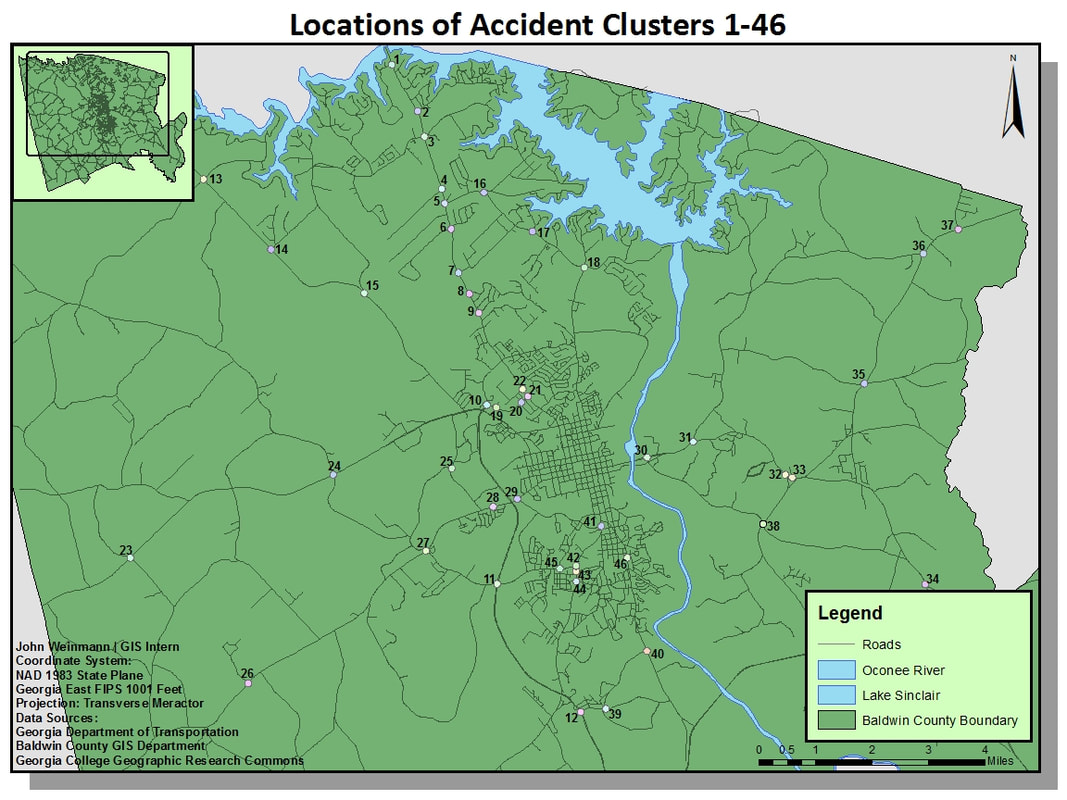
This map shows the location of all accident clusters that both met a minimum, specified density and were located (at least in part) on county roads. A total of 46 clusters were identified across the county for further investigation, representing the most accident-prone locations on the county's roadways. Of these, 10 clusters representing the most dangerous intersections in the county were chosen for deeper analysis.
|
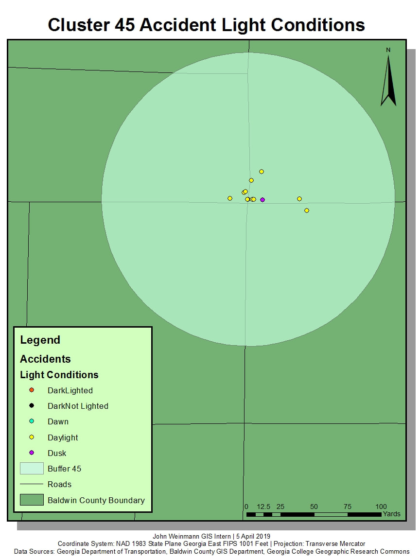
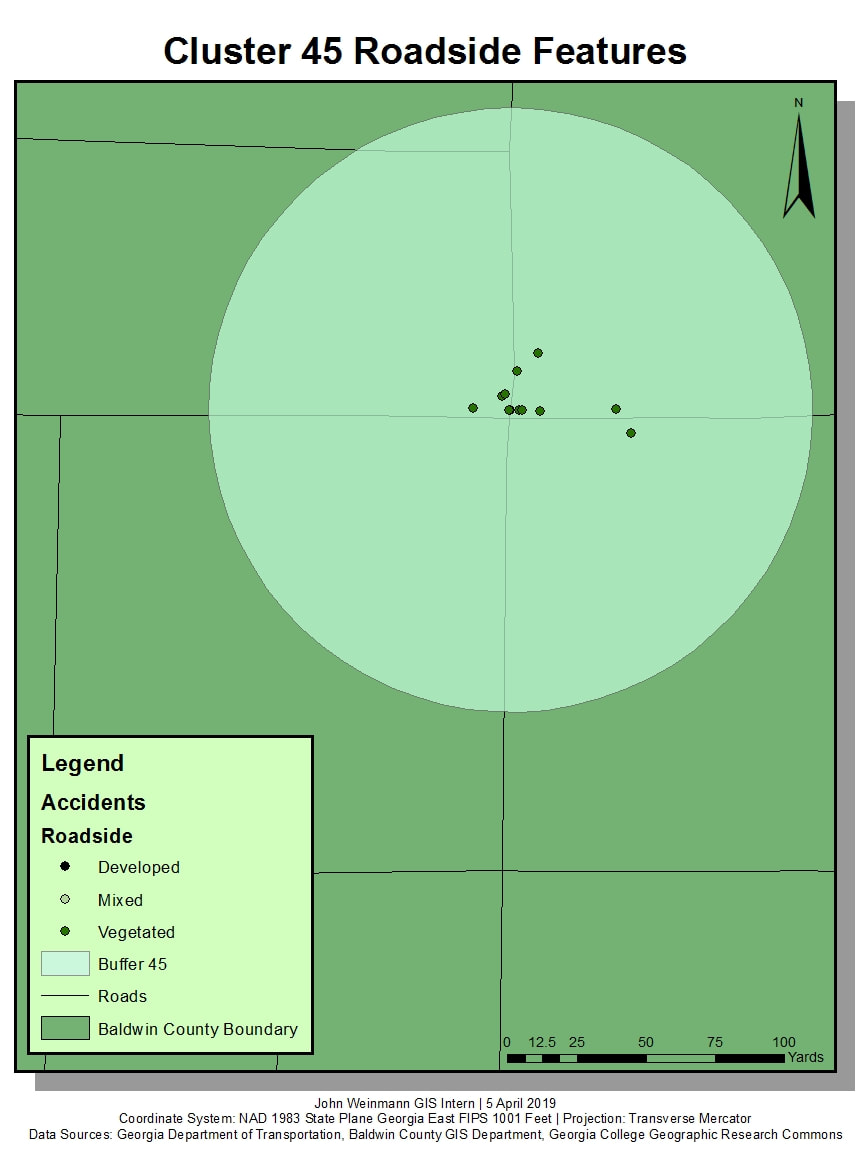
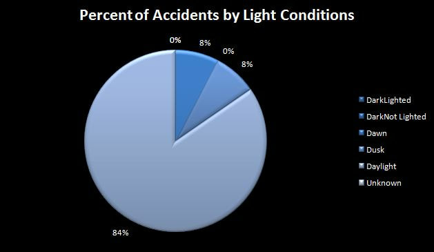
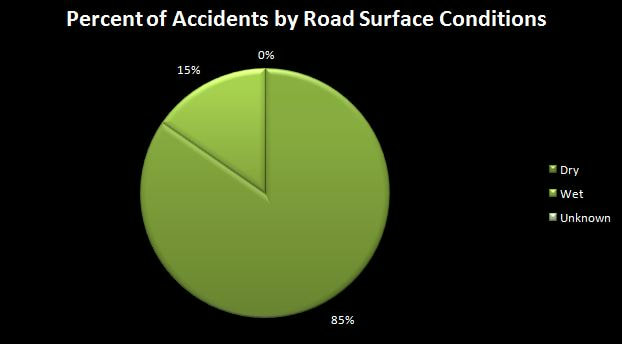
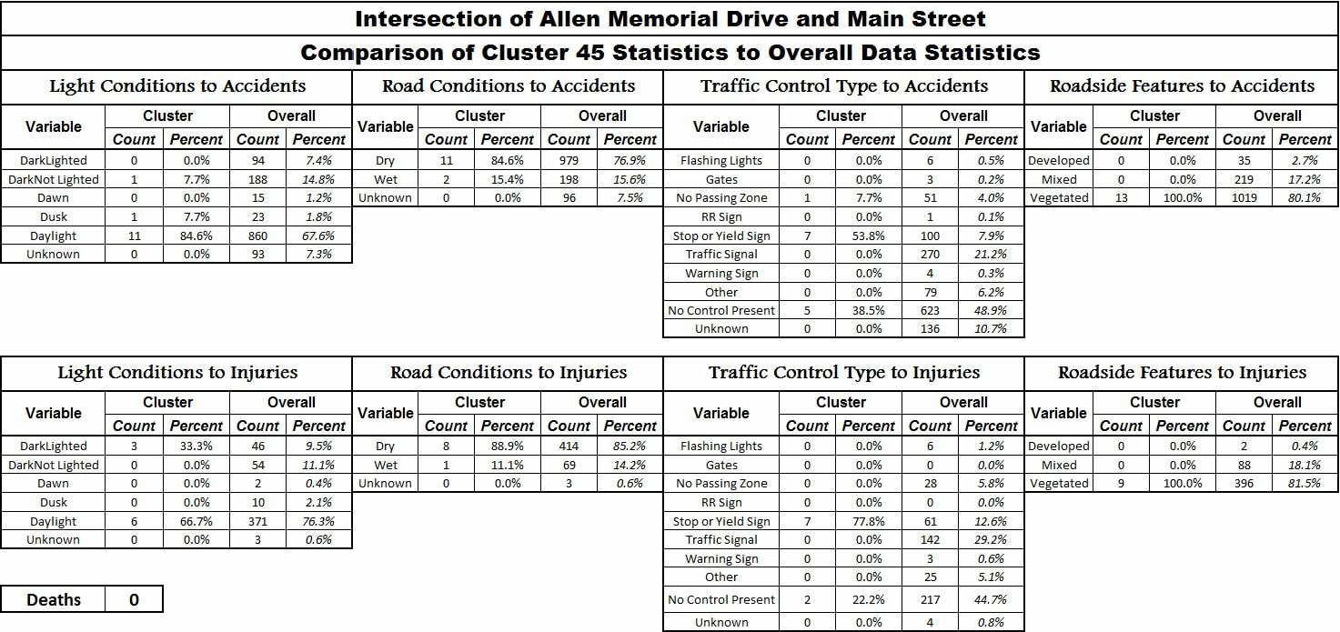
Several maps, charts, graphs, and tables were made for all of the clusters that were chosen for deeper analysis. All of these helped to visualize the findings in order to draw meaningful results and propose recommendations. Below are several samples of maps, charts, graphs, and tables that were created in order to best visualize the data within each accident cluster.


For each of the various clusters, several differing recommendations were given to each. The suggested actions were tailored to each of the individual clusters depending on the data found within each cluster. These recommendations included:
1) Lowering Speed Limits
2) Installing Traffic Signals
3) Installing new and/or improved lighting
4) Ensuring water drains properly from the roads (with consideration to roadside features)
1) Lowering Speed Limits
2) Installing Traffic Signals
3) Installing new and/or improved lighting
4) Ensuring water drains properly from the roads (with consideration to roadside features)
